authors: Joep Coenen, Justin Agyin, Kenzo Joy Lam, Lennart Arpots
location: Rotterdam
The intermediate size of the port : between water and city
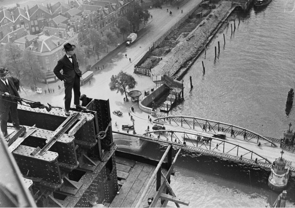
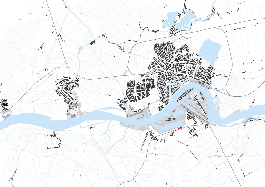
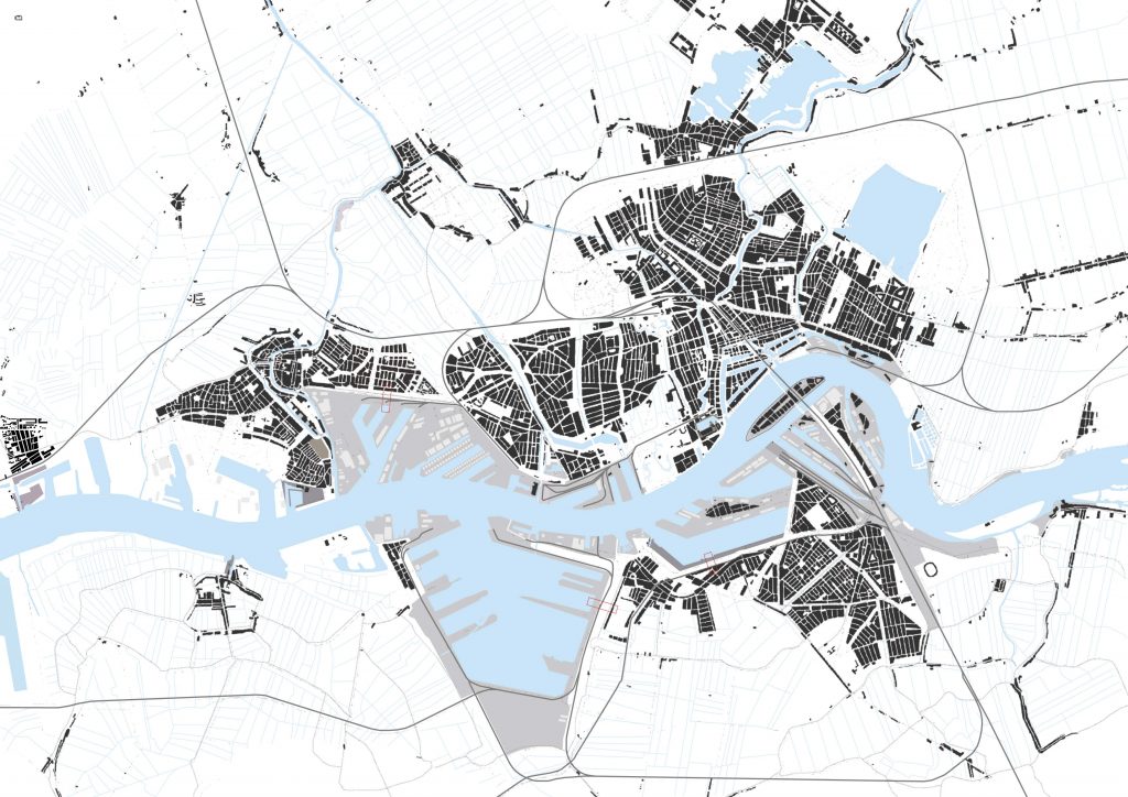
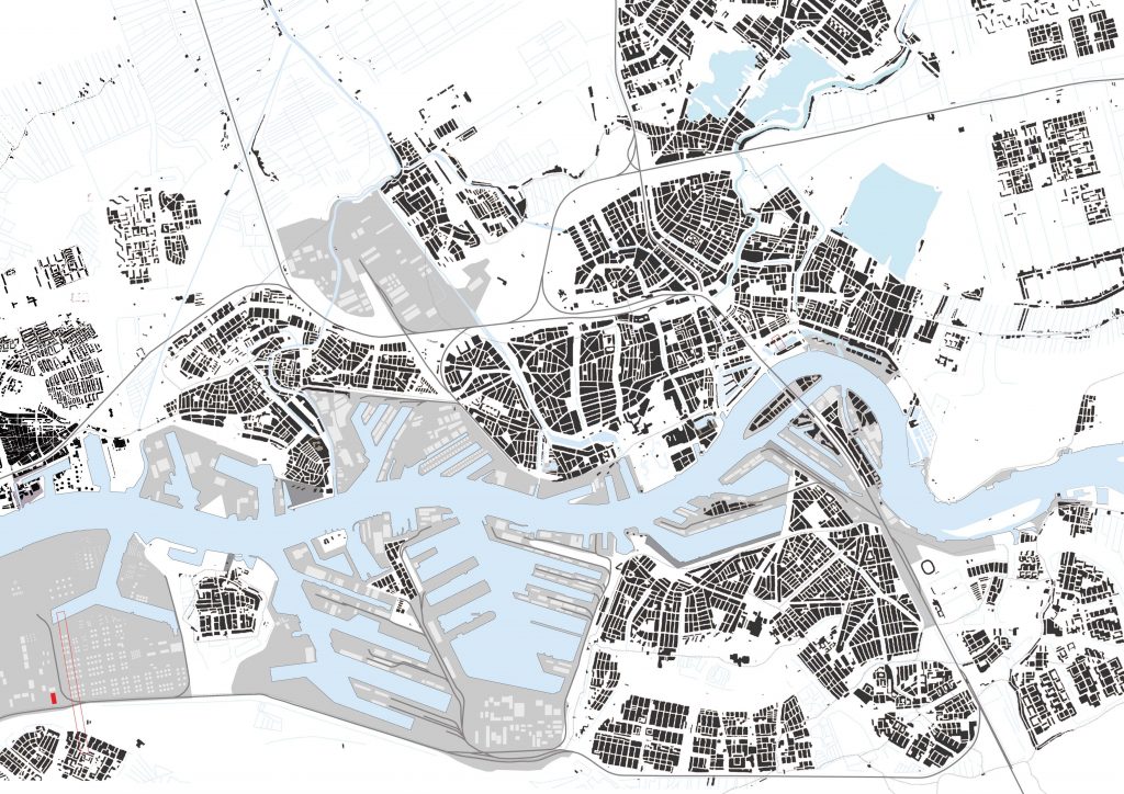
Rotterdam, city with the biggest port of Europe. Much has been written on the urbanism of Rotterdam in relation to this giant port, by Umberto Barbieri, Frits Palmboom, Michelle Provoost and Paul van de Laar to name a few. This research proposes a synthisizing and graphic view of Rotterdam and its port.
This series of graphics is a reduced version of a research on the theme of program in the urban realm, conducted in the graduation studio The Intermediate Size, authored by Justin Agyin, Lennart Arpots, Joep Coenen and Kenzo Lam.
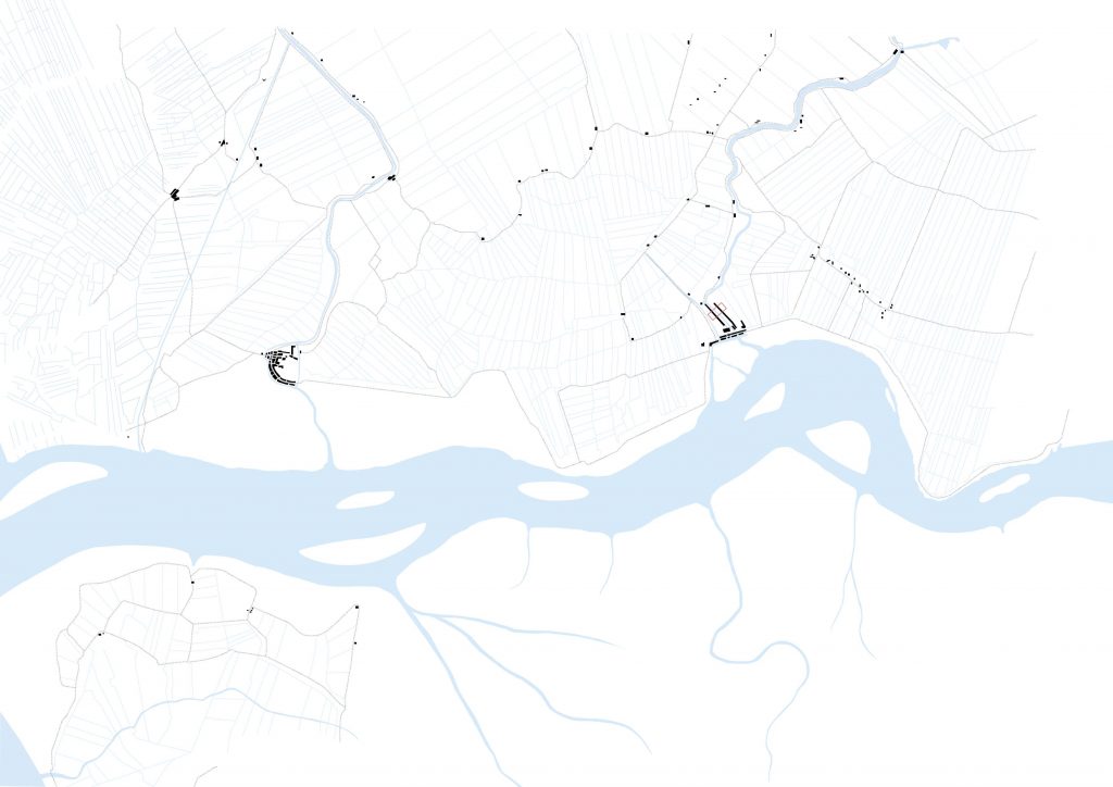
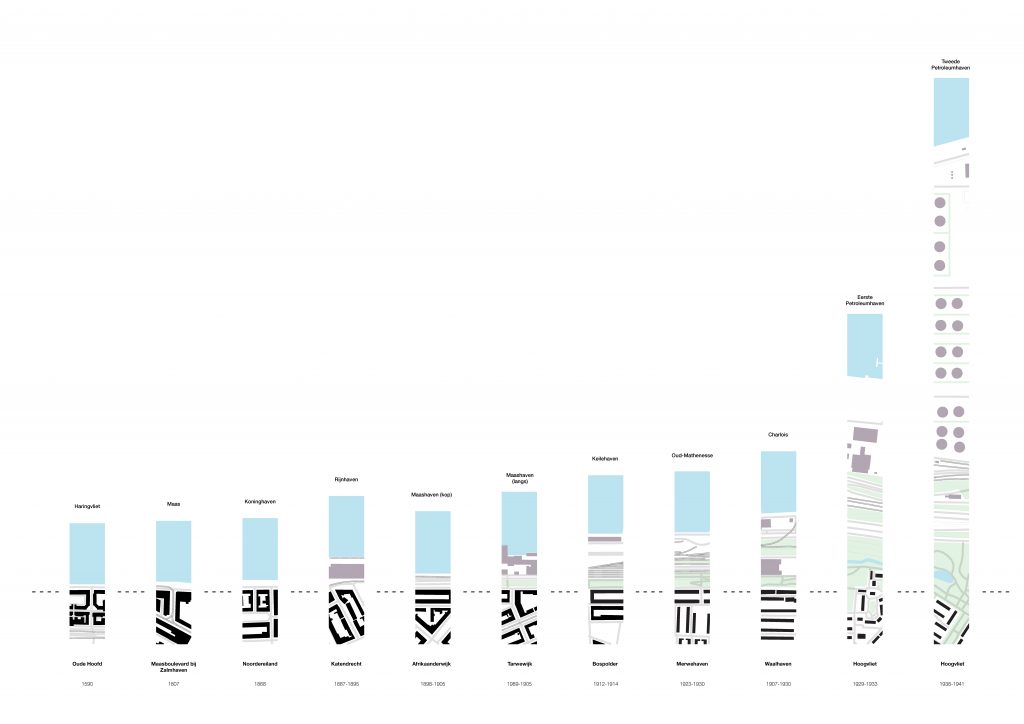
1340
1690
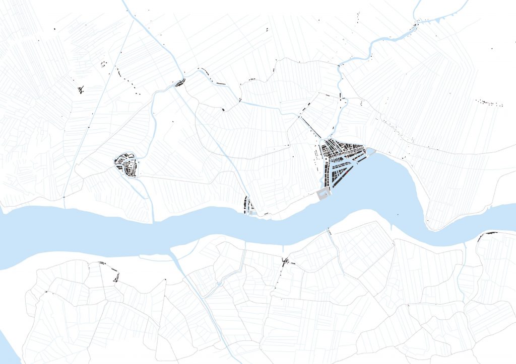
1890
1910
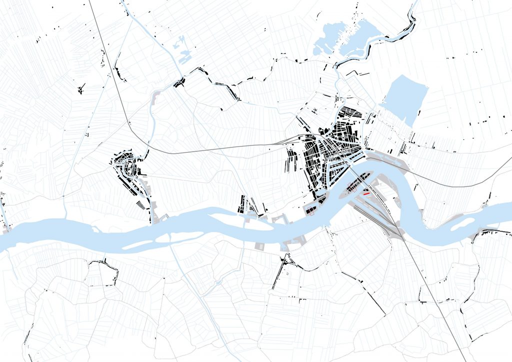
1937
1970
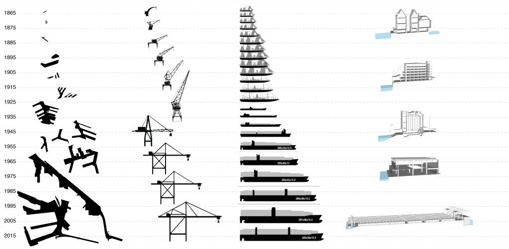
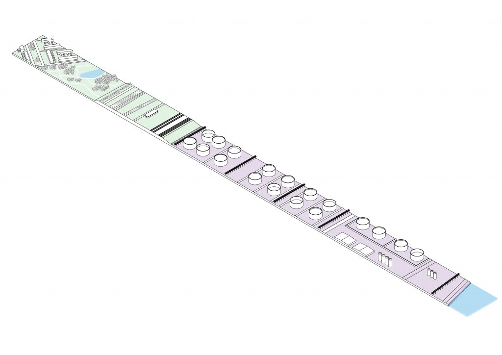
Over the years the distance between city and water has increased inmensely as a result of industrialization, introduction of petroleum, specialization of space and ifnrastructure, globalization and the accompanied development of container shipping.
The port has grown, the distance to the city, but also the sizes of cranes, ships and docks have increased exponentially.
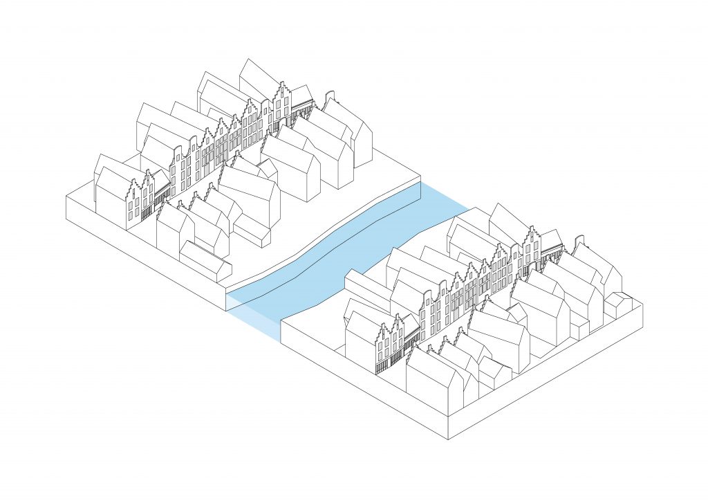
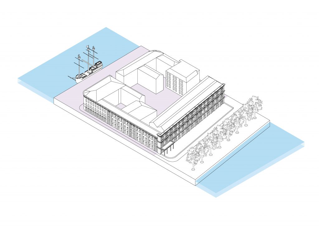
1300s: Densely built up ribbons parallel to the Rotte. Craft, trade and dwelling is mixed in the buildings that form a transitional margin between water infrastructure and land infrastructure.
1400s: Back lots are built up in the late medieval period, the quays get smothered with buildings and the water is increasingly difficult to reach.
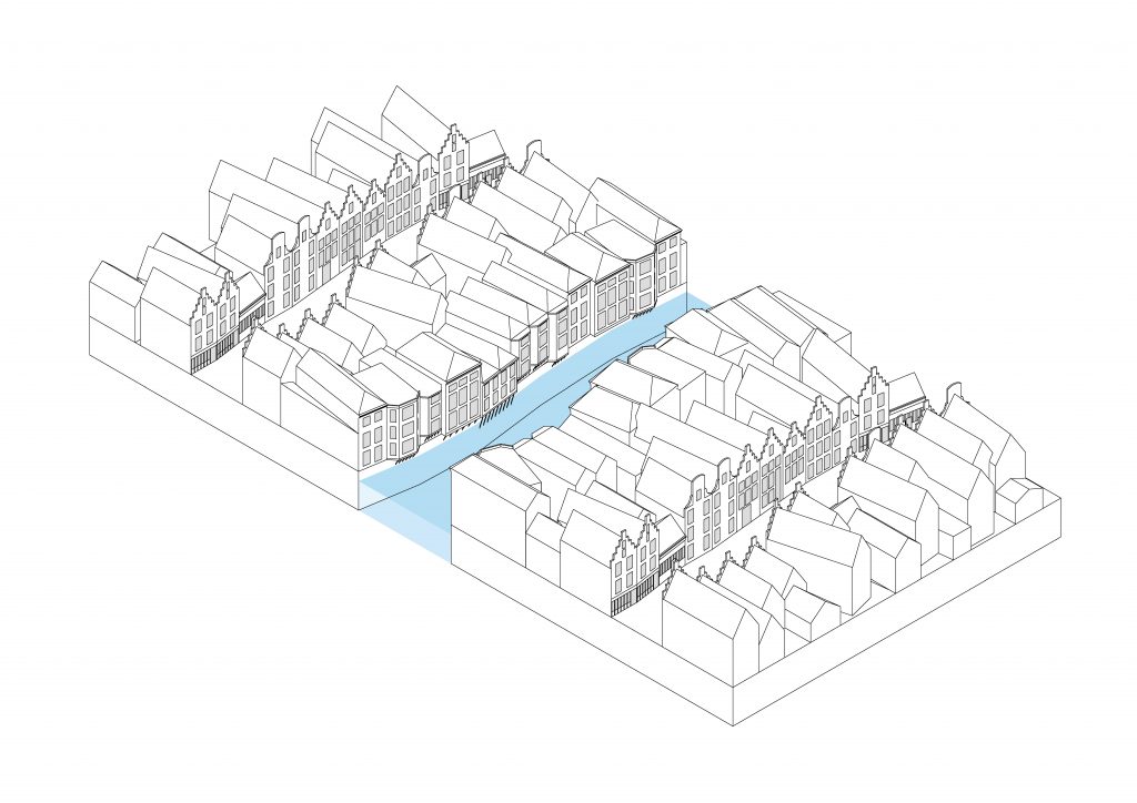
1590: New docks are constructed. The quay becomes the transition between land and water as new buildings face the water with their front façades.
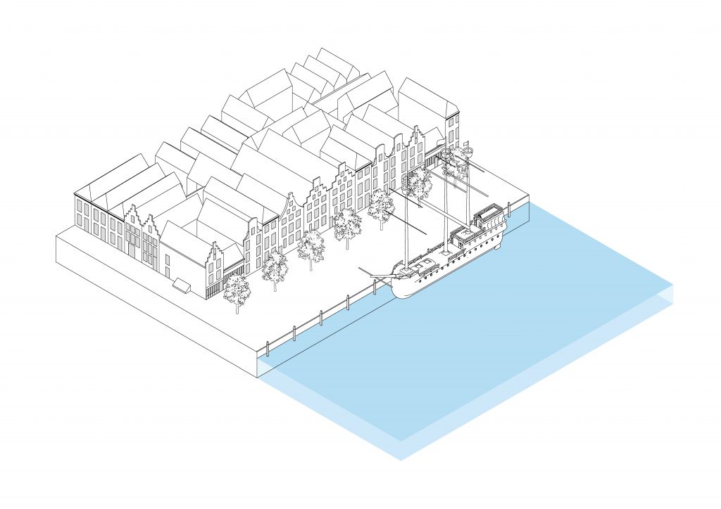
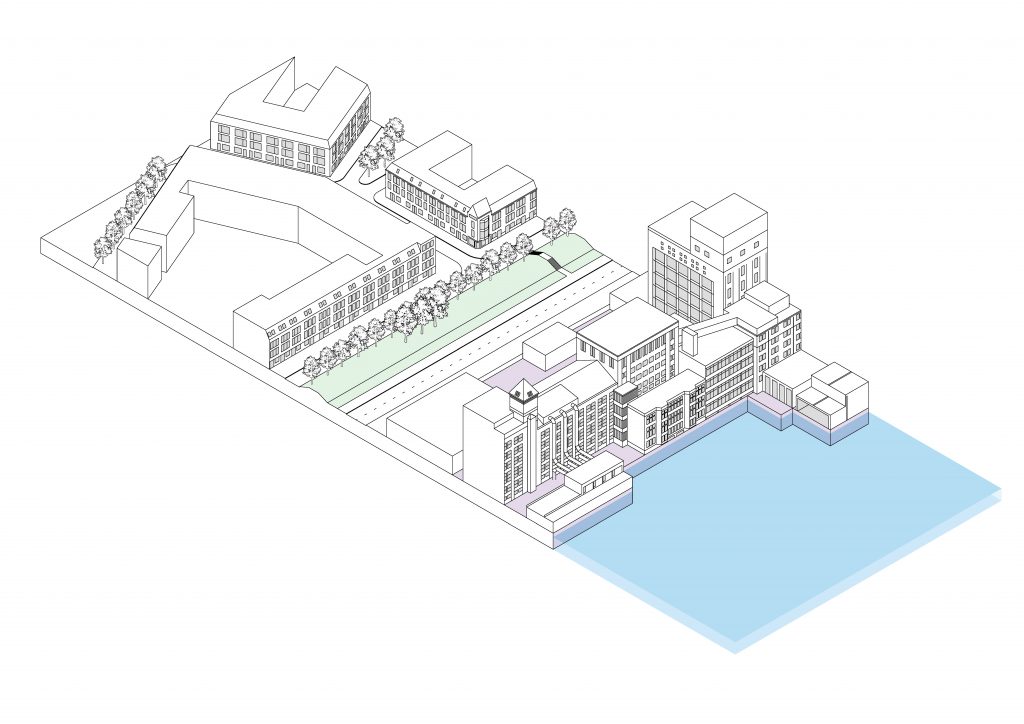
1807: The buildings between Westerhaven and Maasboulevard clearly show a difference between the water used for craft and industry and water used for inland transportation: the buildings facing the latter form a representative front for the city.
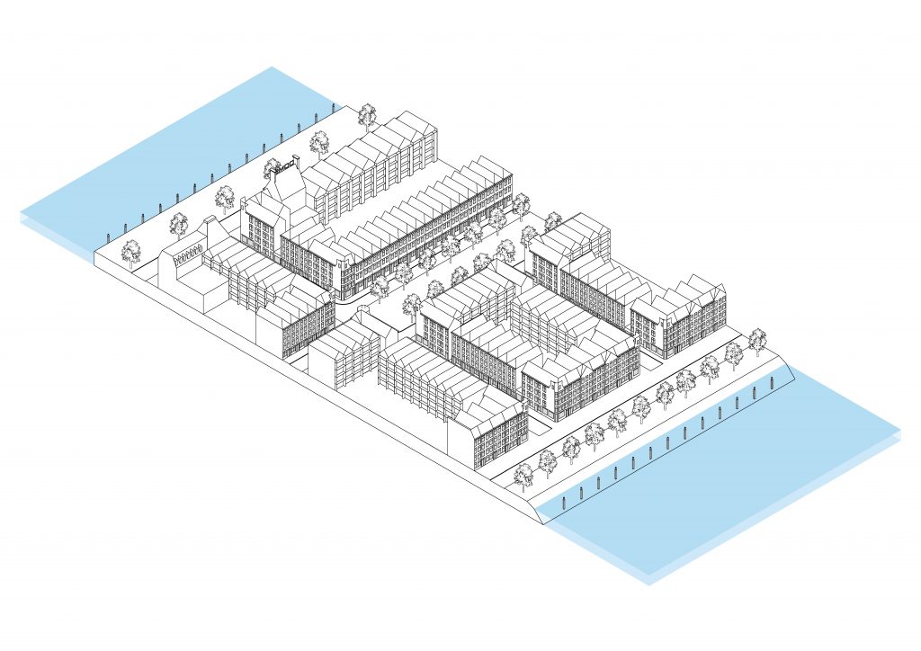
1868: The buildings wedged between the Meuse and Koningshaven are mainly residential, the quays are both used for docking and infrastructure.
1887: For the first time an industrial margin is wedged between the neighborhood and the water, effectively establishing a new relationship between water and city: city->industry<-water.
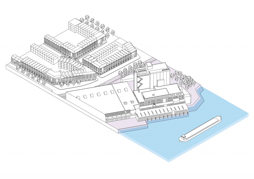
1900: The quays along the Maashaven are lined with ships docked perpendicularly. The distance between the built-up area and the water has increased.
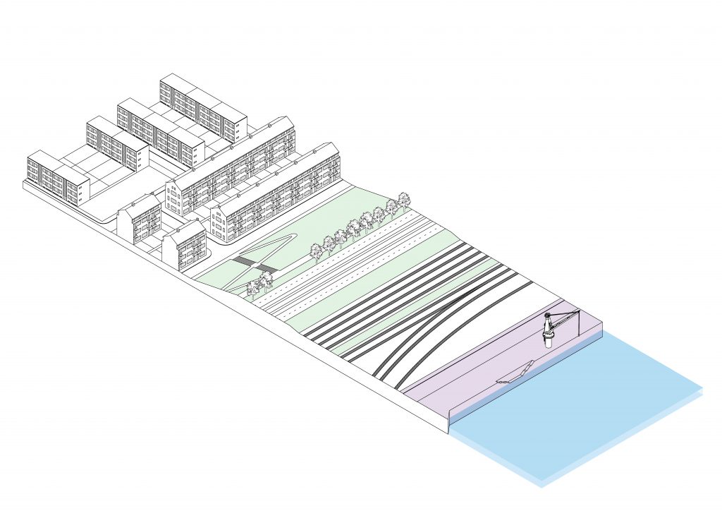
1905: A monopoly on the waterfront has been established by industry. It is separated from the urban area by means of a broad street and a green dike.
1923: At the Merwehaven an extra layer of new infrastructure is inserted between dike and industry: the railroad.
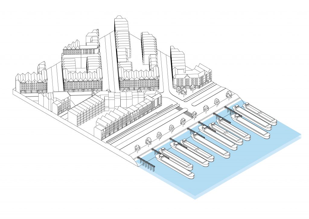
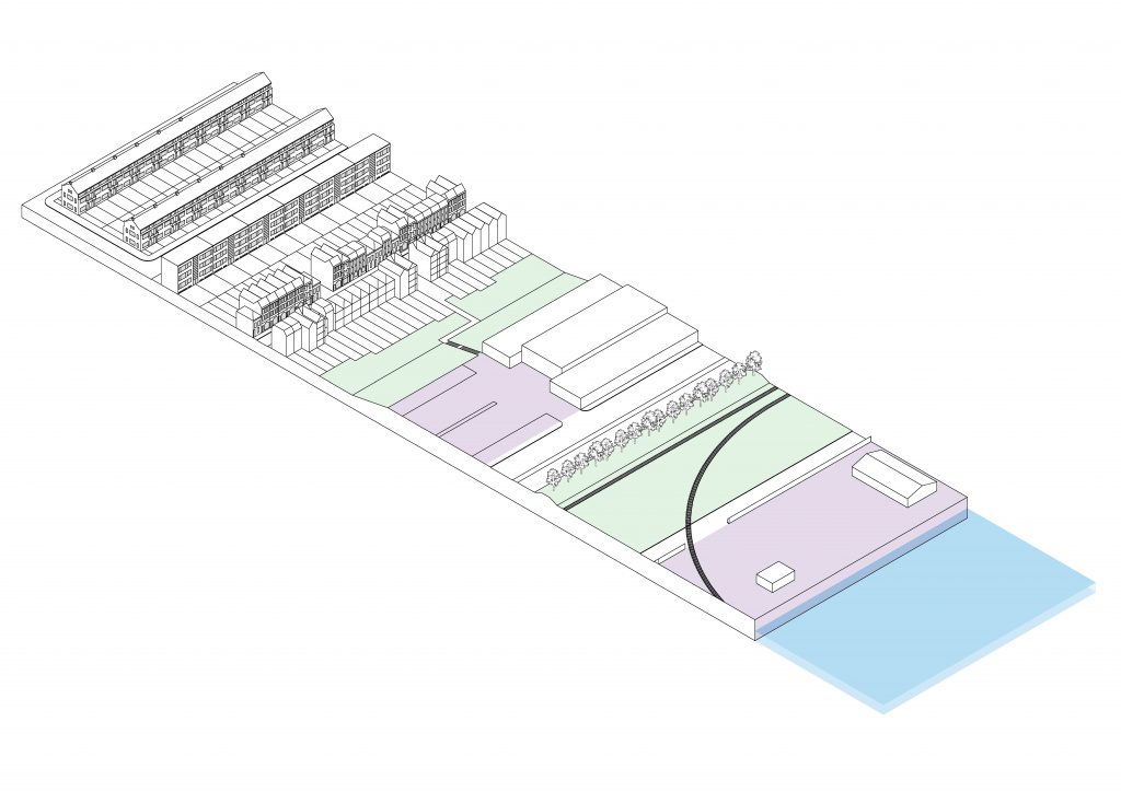
1930: Around the basin of the Waalhaven a second layer of industry is wedged between the parts that now make up the wide open strip between water and city.
1933: At the Eerste Petroleumhaven, a highway is first inserted in the strip of infrastructure, definitively breaking the (however subtle) relationship between the urban and the industrial.
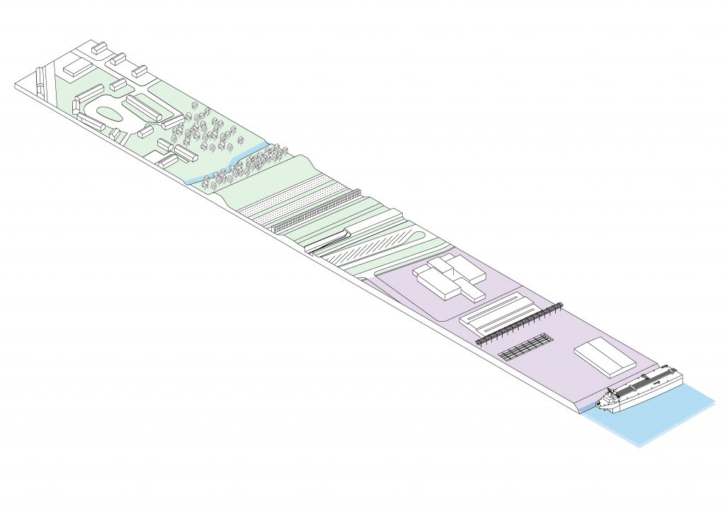
1941: At the Tweede Petroleumhaven the industry starts developing a landscape of its own with the construction of new tankparks and refineries.
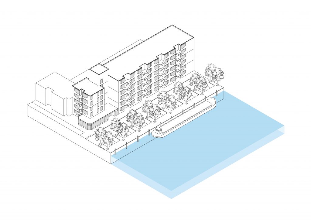
1975: Old docks in the center of the city are converted to a residential function, finally moving the residual industry out of the city. Water and city re-engage in a newfound relationship: a relationship of visual connection and recreation.